Olinda, HI
Approx. 4.9 mi / 7.9 km from park boundary · straight line
Nearby town. Choose a specific park entrance when planning your approach.
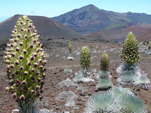
Haleakalā protects contrasting volcanic and rainforest landscapes on Maui, together with important Hawaiian cultural relationships to the land. Its habitats support species found nowhere else.
Find nearby towns, places to stay and useful services for your national park trip. Distances are approximate straight lines from the park boundary or map center, not driving distances.
Local nearby towns to consider when planning your park visit.
Approx. 4.9 mi / 7.9 km from park boundary · straight line
Nearby town. Choose a specific park entrance when planning your approach.
Approx. 6.4 mi / 10.3 km from park boundary · straight line
Nearby town. Choose a specific park entrance when planning your approach.
Approx. 6.9 mi / 11.1 km from park boundary · straight line
Nearby town. Choose a specific park entrance when planning your approach.
Approx. 7.1 mi / 11.4 km from park boundary · straight line
Nearby town. Choose a specific park entrance when planning your approach.
Approx. 7.5 mi / 12.1 km from park boundary · straight line
Nearby town. Choose a specific park entrance when planning your approach.
Approx. 8.3 mi / 13.3 km from park boundary · straight line
Nearby town. Choose a specific park entrance when planning your approach.
Local hotels / lodging to consider when planning your park visit.
Approx. 3.3 mi / 5.3 km from park boundary · straight line
446 Cooke Rd, Kula, HI, 96790, US
Approx. 3.5 mi / 5.6 km from park boundary · straight line
Makawao, HI, US
Local restaurants to consider when planning your park visit.
Approx. 5.1 mi / 8.3 km from park boundary · straight line
1546 Hana Hwy, Hana, HI, 96713, US
Approx. 5.1 mi / 8.3 km from park boundary · straight line
29 Hana Hwy, Hana, HI, 96713, US
Local grocery to consider when planning your park visit.
Approx. 6.5 mi / 10.4 km from park boundary · straight line
9226 Kula Hwy, Kula, HI, 96790-7423, US
Local fuel to consider when planning your park visit.
Approx. 4.8 mi / 7.7 km from park boundary · straight line
4836 Lower Kula Rd, Kula, HI, 96790, US
Local airports to consider when planning your park visit.
Approx. 14.9 mi / 23.9 km from park boundary · straight line
Kahului, HI, US
Local hospitals / pharmacies to consider when planning your park visit.
No nearby places match your search.
Haleakalā protects contrasting volcanic and rainforest landscapes on Maui, together with important Hawaiian cultural relationships to the land. Its habitats support species found nowhere else.
Use this Haleakalā map to choose an approach, reveal place categories and group stops into a realistic day. The summit and coastal Kīpahulu district have separate approaches. Sunrise access has its own reservation requirements.
Drier months may suit general visits, but summit weather stays cold and changeable throughout the year.
Highlighted months are an editorial guide for a general visit. Conditions vary by elevation and activity.
The summit and Kīpahulu have markedly different climates. High elevations can be cold, and clouds or rain can quickly replace sunshine in either district.
The summit and coastal Kīpahulu district have separate approaches. Sunrise access has its own reservation requirements.
Check the date on saved information. Road, trail and weather conditions can change after a map is downloaded.
Choose from hiking, camping, stargazing, ranger programs. Match each activity to the season, your group’s ability and the access requirements for that particular place.
Choose either the summit or coastal district for the day. Plan clothing, start time and driving time around that district's elevation and approach.
Build your park day on the mapLocated on the island of Maui, Haleakalā National Park extends from the 10,023 foot (3055m) summit of Haleakalā down the southeast flank of the mountain to the Kīpahulu coast near Hana. These two sections of the park are not directly connected by road, but both can be reached from Kahului. There are no gas stations within the park.
Check official conditions before travel. Directory-listed locations are not a guarantee of current opening or road access.
Use the parking and shuttle layers to see the locations included in this map edition. A mapped space or stop does not confirm capacity, a timetable or present-day operation.
Save this park map while connected. Your saved plan stays in this browser; export a backup before changing devices.
$30 · private vehicle
Camping, transport, tours and reservations can cost extra. Pass coverage and group eligibility vary.
| Charge | USD | Basis |
|---|---|---|
| Motorcycle | $25.00 | Valid for 3 days |
| Private vehicle | $30.00 | Valid for 3 days |
| Per person | $15.00 | Standard entrance; check eligibility and duration |
Fee snapshot checked 2026-10-05. Camping, reservations, tours and transport can cost extra. Amounts are planning information, not a booking quote.
Toggle a category to show its icons. Empty categories mean no mapped location is included in this edition. Use the list alternative to select every mapped point.
These are planning suggestions, not forecasts or live crowd measurements. Select a month for its details.
Use a single entrance or arrival area and group nearby stops. A one-day plan is a selective introduction. Choose either the summit or coastal district for the day. Plan clothing, start time and driving time around that district's elevation and approach.
Focus: The summit and coastal Kīpahulu district have separate approaches. Sunrise access has its own reservation requirements.
Build this park day →Use the first day for an accessible introduction and a second day for a distinct area or longer activity. Choose either the summit or coastal district for the day. Plan clothing, start time and driving time around that district's elevation and approach.
Focus: The summit and coastal Kīpahulu district have separate approaches. Sunrise access has its own reservation requirements.
Build this park day →Plan two compact days around a sensible base and avoid spending the whole visit changing areas. Choose either the summit or coastal district for the day. Plan clothing, start time and driving time around that district's elevation and approach.
Focus: The summit and coastal Kīpahulu district have separate approaches. Sunrise access has its own reservation requirements.
Build this park day →The summit and coastal Kīpahulu district have separate approaches. Sunrise access has its own reservation requirements. Review entry, transport and activity bookings for your dates; a map icon is not a reservation.
Verify for your travel datesReservations are required to camp at Hosmer Grove Campground. Confirm the rules for your chosen campground and dates.
Record checked 2026-10-05Choose from hiking, camping, stargazing, ranger programs. Match each activity to the season, your group’s ability and the access requirements for that particular place. An entrance pass does not replace a tour ticket, campsite booking or activity permit.
Record checked 2026-10-05A Junior Ranger activity or booklet is listed at Headquarters Visitor Center. Choose either the summit or coastal district for the day. Plan clothing, start time and driving time around that district's elevation and approach.
Pet access is area-specific. Check the exact trail, campground and transport rules before bringing an animal; the map does not label the whole park pet friendly. Service-animal rules differ from pet rules.
Directory-listed wheelchair-accessible facilities include Headquarters Visitor Center, Kīpahulu Visitor Center . These can be outside the park boundary. Choose specific facilities and check surfaces, grades, restrooms and transport before travel; a general park tag does not establish accessibility.
The summit and Kīpahulu have markedly different climates. High elevations can be cold, and clouds or rain can quickly replace sunshine in either district. The summit and coastal Kīpahulu district have separate approaches. Sunrise access has its own reservation requirements.
Nearest park reference points by straight-line distance. Roads, water crossings and travel time are different.
The summit and Kīpahulu have markedly different climates. High elevations can be cold, and clouds or rain can quickly replace sunshine in either district.
Located on the island of Maui, Haleakalā National Park extends from the 10,023 foot (3055m) summit of Haleakalā down the southeast flank of the mountain to the Kīpahulu coast near Hana. These two sections of the park are not directly connected by road, but both can be reached from Kahului. There are no gas stations within the park. Check the official directions page for current routing details.
NPS lists these access features: Restroom - Accessible, Wheelchair Accessible. This describes that facility, not the accessibility of every area of the park.
The NPS directory lists Headquarters Visitor Center; Haleakalā Visitor Center; Kīpahulu Visitor Center. The Headquarters Visitor Center is 1 mile (1.6 km) past the Summit District entrance gate. Inside, park staff can answer questions at the information desk. A small exhibit hall features displays on the park's natural and cultural history. Please check park alerts for information on closures. Check the linked park information before relying on opening hours or services.
Keep a wishlist, mark parks visited and save named trips in this browser. Export a backup before changing devices.
Open My Parks →Create a clean PDF or PNG with a map, numbered park legend and checklist. National exports include Alaska, Hawaii and the territories.
Open Print Studio →