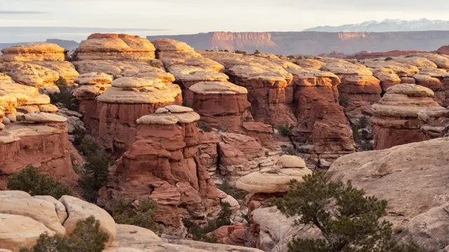
The Colorado and Green rivers divide Canyonlands into distinct districts of canyons, mesas and spires. Roads do not connect the districts inside the park, so choosing an area matters before setting out.
Find nearby towns, places to stay and useful services for your national park trip. Distances are approximate straight lines from the park boundary or map center, not driving distances.
Nearby towns 6
Local nearby towns to consider when planning your park visit.
⌂
Moab, UT
Approx. 12.8 mi / 20.6 km from park boundary · straight line
Nearby town. Choose a specific park entrance when planning your approach.
⌂
Spanish Valley, UT
Approx. 17.0 mi / 27.3 km from park boundary · straight line
Nearby town. Choose a specific park entrance when planning your approach.
⌂
Castle Valley, UT
Approx. 22.0 mi / 35.4 km from park boundary · straight line
Nearby town. Choose a specific park entrance when planning your approach.
⌂
La Sal, UT
Approx. 25.1 mi / 40.4 km from park boundary · straight line
Nearby town. Choose a specific park entrance when planning your approach.
⌂
Thompson Springs, UT
Approx. 31.7 mi / 51.0 km from park boundary · straight line
Nearby town. Choose a specific park entrance when planning your approach.
⌂
Green River, UT
Approx. 35.0 mi / 56.3 km from park boundary · straight line
Nearby town. Choose a specific park entrance when planning your approach.
Hotels / lodging 5
Local hotels / lodging to consider when planning your park visit.
▤
Canyonlands Needles Outpost
Approx. 0.0 mi / 0.0 km from park boundary · straight line
Plan your visit with the Canyonlands National Park map
The Colorado and Green rivers divide Canyonlands into distinct districts of canyons, mesas and spires. Roads do not connect the districts inside the park, so choosing an area matters before setting out.
Use this Canyonlands map to choose an approach, reveal place categories and group stops into a realistic day. Island in the Sky, the Needles and the Maze are separate districts; do not treat them as one continuous visitor road loop.
Suggested monthsApr, May, Sep, Oct
Entrance fee$30 · private vehicle
Plan your time2–3 day guide
Map accessDrive access
Best months and weather
Spring and fall are useful for desert visits. Summer heat, winter ice and storms require different plans.
Jan
Feb
Mar
Apr
May
Jun
Jul
Aug
Sep
Oct
Nov
Dec
Highlighted months are an editorial guide for a general visit. Conditions vary by elevation and activity.
Weather to plan for
This high desert has large day-to-night temperature changes. Summers can be extremely hot, winters cold, and spring and fall generally more moderate.
Seasonal access
Island in the Sky, the Needles and the Maze are separate districts; do not treat them as one continuous visitor road loop.
Before you set out
Check the date on saved information. Road, trail and weather conditions can change after a map is downloaded.
Choose from hiking, camping, scenic driving, boating, stargazing, cycling, ranger programs, horseback riding. Match each activity to the season, your group’s ability and the access requirements for that particular place.
A practical Canyonlands day plan
Choose one district per day. Plan a few overlooks or a single hike and keep remote four-wheel-drive routes out of a standard sightseeing plan.
Canyonlands National Park is cut into three land districts by the Green and Colorado rivers. Island in the Sky, in the north of the park, is about 40 minutes from Moab, UT via UT 313. The Maze district, in the west of the park, is the most remote and challenging; its ranger station is down 46 miles of dirt road from UT 24. All roads in The Maze require high-clearance 4WD.
Choose your approach
Check official conditions before travel. Directory-listed locations are not a guarantee of current opening or road access.
Parking, shuttles and facilities
Use the parking and shuttle layers to see the locations included in this map edition. A mapped space or stop does not confirm capacity, a timetable or present-day operation.
Offline planning
Save this park map while connected. Your saved plan stays in this browser; export a backup before changing devices.
Entrance fees and visit costs
$30 · private vehicle
Camping, transport, tours and reservations can cost extra. Pass coverage and group eligibility vary.
Charge
USD
Basis
Private vehicle
$30.00
Standard entrance; check eligibility and duration
Motorcycle
$25.00
Valid for 7 days
Per person
$15.00
Standard entrance; check eligibility and duration
Fee snapshot checked 2026-10-05. Camping, reservations, tours and transport can cost extra. Amounts are planning information, not a booking quote.
What you can find on the park map
Toggle a category to show its icons. Empty categories mean no mapped location is included in this edition. Use the list alternative to select every mapped point.
CHOOSE YOUR SEASON
Your month-by-month park map
These are planning suggestions, not forecasts or live crowd measurements. Select a month for its details.
JanVariable
Weather & access
This high desert has large day-to-night temperature changes. Summers can be extremely hot, winters cold, and spring and fall generally more moderate.
Planning your visit
Island in the Sky, the Needles and the Maze are separate districts; do not treat them as one continuous visitor road loop.
No live crowd measurement is included. Allow time for parking, transport and popular stops.
FebVariable
Weather & access
This high desert has large day-to-night temperature changes. Summers can be extremely hot, winters cold, and spring and fall generally more moderate.
Planning your visit
Island in the Sky, the Needles and the Maze are separate districts; do not treat them as one continuous visitor road loop.
No live crowd measurement is included. Allow time for parking, transport and popular stops.
MarVariable
Weather & access
This high desert has large day-to-night temperature changes. Summers can be extremely hot, winters cold, and spring and fall generally more moderate.
Planning your visit
Island in the Sky, the Needles and the Maze are separate districts; do not treat them as one continuous visitor road loop.
No live crowd measurement is included. Allow time for parking, transport and popular stops.
AprRecommended
Weather & access
This high desert has large day-to-night temperature changes. Summers can be extremely hot, winters cold, and spring and fall generally more moderate.
Planning your visit
Spring and fall are useful for desert visits. Summer heat, winter ice and storms require different plans.
No live crowd measurement is included. Allow time for parking, transport and popular stops.
MayRecommended
Weather & access
This high desert has large day-to-night temperature changes. Summers can be extremely hot, winters cold, and spring and fall generally more moderate.
Planning your visit
Spring and fall are useful for desert visits. Summer heat, winter ice and storms require different plans.
No live crowd measurement is included. Allow time for parking, transport and popular stops.
JunVariable
Weather & access
This high desert has large day-to-night temperature changes. Summers can be extremely hot, winters cold, and spring and fall generally more moderate.
Planning your visit
Island in the Sky, the Needles and the Maze are separate districts; do not treat them as one continuous visitor road loop.
No live crowd measurement is included. Allow time for parking, transport and popular stops.
JulVariable
Weather & access
This high desert has large day-to-night temperature changes. Summers can be extremely hot, winters cold, and spring and fall generally more moderate.
Planning your visit
Island in the Sky, the Needles and the Maze are separate districts; do not treat them as one continuous visitor road loop.
No live crowd measurement is included. Allow time for parking, transport and popular stops.
AugVariable
Weather & access
This high desert has large day-to-night temperature changes. Summers can be extremely hot, winters cold, and spring and fall generally more moderate.
Planning your visit
Island in the Sky, the Needles and the Maze are separate districts; do not treat them as one continuous visitor road loop.
No live crowd measurement is included. Allow time for parking, transport and popular stops.
SepRecommended
Weather & access
This high desert has large day-to-night temperature changes. Summers can be extremely hot, winters cold, and spring and fall generally more moderate.
Planning your visit
Spring and fall are useful for desert visits. Summer heat, winter ice and storms require different plans.
No live crowd measurement is included. Allow time for parking, transport and popular stops.
OctRecommended
Weather & access
This high desert has large day-to-night temperature changes. Summers can be extremely hot, winters cold, and spring and fall generally more moderate.
Planning your visit
Spring and fall are useful for desert visits. Summer heat, winter ice and storms require different plans.
No live crowd measurement is included. Allow time for parking, transport and popular stops.
NovVariable
Weather & access
This high desert has large day-to-night temperature changes. Summers can be extremely hot, winters cold, and spring and fall generally more moderate.
Planning your visit
Island in the Sky, the Needles and the Maze are separate districts; do not treat them as one continuous visitor road loop.
No live crowd measurement is included. Allow time for parking, transport and popular stops.
DecVariable
Weather & access
This high desert has large day-to-night temperature changes. Summers can be extremely hot, winters cold, and spring and fall generally more moderate.
Planning your visit
Island in the Sky, the Needles and the Maze are separate districts; do not treat them as one continuous visitor road loop.
No live crowd measurement is included. Allow time for parking, transport and popular stops.
MAKE TIME FOR THE GOOD PART
How long do you have?
1 day
One area, one memorable day
Use a single entrance or arrival area and group nearby stops. A one-day plan is a selective introduction. Choose one district per day. Plan a few overlooks or a single hike and keep remote four-wheel-drive routes out of a standard sightseeing plan.
Focus: Island in the Sky, the Needles and the Maze are separate districts; do not treat them as one continuous visitor road loop.
Give separate areas their own days and build in room for weather and transfers. Choose one district per day. Plan a few overlooks or a single hike and keep remote four-wheel-drive routes out of a standard sightseeing plan.
Focus: Island in the Sky, the Needles and the Maze are separate districts; do not treat them as one continuous visitor road loop.
Use a base or carefully planned transfers to explore more deeply, with a flexible weather day. Choose one district per day. Plan a few overlooks or a single hike and keep remote four-wheel-drive routes out of a standard sightseeing plan.
Focus: Island in the Sky, the Needles and the Maze are separate districts; do not treat them as one continuous visitor road loop.
Island in the Sky, the Needles and the Maze are separate districts; do not treat them as one continuous visitor road loop. Review entry, transport and activity bookings for your dates; a map icon is not a reservation.
Verify for your travel dates
Camping example: Island in the Sky (Willow Flat) Campground
Rules vary by campground
All sites are first-come, first-served. We do not take reservations. Campsites fill most days spring through fall. Confirm the rules for your chosen campground and dates.
Record checked 2026-10-05
Activities & permits
Activity-specific requirements
Choose from hiking, camping, scenic driving, boating, stargazing, cycling, ranger programs, horseback riding. Match each activity to the season, your group’s ability and the access requirements for that particular place. An entrance pass does not replace a tour ticket, campsite booking or activity permit.
Record checked 2026-10-05
Make the visit work for you
Families & children
A Junior Ranger activity or booklet is listed at The Needles Visitor Center. Choose one district per day. Plan a few overlooks or a single hike and keep remote four-wheel-drive routes out of a standard sightseeing plan.
Bringing a pet
Pet access is area-specific. Check the exact trail, campground and transport rules before bringing an animal; the map does not label the whole park pet friendly. Service-animal rules differ from pet rules.
Accessibility
Directory-listed wheelchair-accessible facilities include Island in the Sky Visitor Center, The Needles Visitor Center. These can be outside the park boundary. Choose specific facilities and check surfaces, grades, restrooms and transport before travel; a general park tag does not establish accessibility.
Before you set out
This high desert has large day-to-night temperature changes. Summers can be extremely hot, winters cold, and spring and fall generally more moderate. Island in the Sky, the Needles and the Maze are separate districts; do not treat them as one continuous visitor road loop.
Explore nearby national park maps
Nearest park reference points by straight-line distance. Roads, water crossings and travel time are different.
This high desert has large day-to-night temperature changes. Summers can be extremely hot, winters cold, and spring and fall generally more moderate.
How does NPS describe getting to Canyonlands?
Canyonlands National Park is cut into three land districts by the Green and Colorado rivers. Island in the Sky, in the north of the park, is about 40 minutes from Moab, UT via UT 313. The Maze district, in the west of the park, is the most remote and challenging; its ranger station is down 46 miles of dirt road from UT 24. All roads in The Maze require high-clearance 4WD. Check the official directions page for current routing details.
What access features does NPS describe at Island in the Sky Visitor Center?
NPS lists these access features: Wheelchair Accessible. This describes that facility, not the accessibility of every area of the park.
Where does NPS list visitor information for Canyonlands?
The NPS directory lists Island in the Sky Visitor Center; The Needles Visitor Center; Hans Flat Ranger Station. The Island in the Sky Visitor Center offers exhibits, book & map sales, park orientation film, backcountry permits, general information, vault toilets, and park rangers on duty. Check the linked park information before relying on opening hours or services.
Make the map yours
Keep a wishlist, mark parks visited and save named trips in this browser. Export a backup before changing devices.